Rail - Energy - Road
SmartDigital combines Innovation with Security
High-tech company SmartDigital offers modern platform services
and customized UAS solutions via its subsidiary EuroDragons.
Companies with critical infrastructure, such as railway, energy or road operators, have an obligation to maintain its safety around the clock. In general maintenance and inspections are carried out during regular operations times. Therefore, problems must not only be detected promptly, but also rectified quickly. In a worst-case-scenario they can even endanger people’s lives or, in the event of a power failure, paralyze entire regions. For this reason, it is important to carry out regular status checks of roads, rails, power lines, pylons and associated structures that are subject to stringent safety requirements at any time.
There is an essential need to inventory structural assets, to store them centrally and to detect signs of wear and tear at an early stage. Damage must be identified as soon as possible so that railroad tracks, roads and trails are always navigable and ready for use. This requires perfectly coordinated inspection and maintenance plans, making it possible, for example, to precisely time tree pruning and to quickly detect and remove fallen trees. Doing so protects overhead power lines from damage and prevents accidents. A time-consuming undertaking for critical infrastructure operators especially in the past fear years where extreme weather situations have risen dramatically.
Even today, checking every detail along every single kilometer is not only arduous work, but can also mean less than optimal operating conditions or can even lead to closures. For example, roads have to be blocked off for checks, sections of railroad track have to be shut down for walking inspections in narrow, hard-to-reach places, or when it is not clear if damage has occurred after a heavy storm.
Support from SmartDigital’s UAS– and IT-platform ARCA© can significantly increase the security and cost-efficiency of critical infrastructure. The highly scalable service delivery platform ARCA© stores data from sensors on land, at sea or in the air or other data in a tamper-proof blockchain. AI then analyzes the data using an end-to-end process, thereby automating and optimizing personnel, cost and time-intensive processes, as well as process prone to error. As a result, companies are better able to meet their challenges.
InfraScore | A One-Stop-Shop Web Platform
Onboarding in the Asset Management Cockpit InfraScore
Selection of the appropriate UAS- and IT-services
Data collection by means of UAS flight (time-controlled or as needed) or data from other sources (ERP systems, stationary sensors, sensors on water and on land)
5G data transmission in real time to the end-to-end service delivery platform ARCA©
AI analysis and evaluation based on existing entries and learned patterns
As-needed and customized activation of IoT-triggers
Transparent, tamper-proof and legally secure data protection in a private blockchain
Automated reporting and billing
SmartDigital has developed ARCA©, a highly scalable service delivery platform, in order to respond flexibly to customers’ needs. Customers benefit from an as-a-service model that provides everything from needs assessment to reporting and billing from a single source using technologies such as AI, RPA (robotic process automation), deep learning, the Internet of Things and the blockchain.
Unmanned aerial vehicles (UAS) stationed in the vicinity are launched on a time-controlled basis or as needed, such as after natural disasters, and fly along a previously defined route following geocoordinates. Various sensors provide data ranging from high-resolution RGB film recordings to detailed laser- and infrared-images of the condition of routes, lines or buildings. This data is collected and transmitted to ARCA©. If desired, the flights also provide a live feed for customers to get an initial overview of the situation. Once the data collection is complete, the ARCA© platform’s AI checks whether any deviations from the learned norm have been detected and activates an IoT trigger if necessary. For example, this trigger could be an automated message sent to the employees responsible for handling an anomaly, which includes georeferenced photos, so that they can assess and remedy the situation as soon as possible. The data is documented in a tamper-proof and legally secure manner using blockchain and can be processed further if needed.
What does SmartDigital do?

©ARCA-Features:
Automated, transparent and tamper-proof
Fully automated data analysis, 2D-images, 3D-modeling, 3D-VR-models (digital twin), multispectral imaging, laser imaging, AI-powered data analysis, IoT alert system, automated reporting, complete and legally compliant documentation, fully automated invoicing, long-term data management.
All orders and reports are displayed clearly and can be easily accessed in SmartDigital’s asset management cockpit “InfraScore”.
Detailed monitoring of extensive areas with BVLOS flights using UAS
Complete documentation including georeferenced image data
Asset monitoring, inspections, inventory, maintenance, documentation and planning
Improving occupational safety
Reducing overall inspection time
Trackmen and inspectors are guided precisely to areas with detected anomalies.
Customizable IoT-trigger enable very fast response times
Natural hazard management, even in difficult terrain

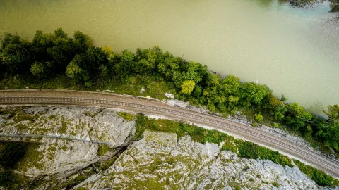
Transport infrastructure | Rail

Energy Infrastructure | Energy

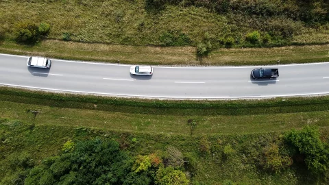
Transport infrastructure | Road
SmartDigital for Rail Network Operators
With the help of UAS and SmartDigital, rail network operators can simplify any number of processes– be it inventory, status monitoring, planning new routes or response in the event of a malfunction. Even early on in the planning stages of new lines or repair work on existing lines, terrain can be measured precisely and visually rendered using 3D-models. Likewise, the progress of construction can be documented effortlessly from the air.
SmartDigital offers attractive options, not only for planned repair work, but also for regular operations. It can simplify the inspection of hard-to-reach places, routine infrastructure checks or vegetation monitoring, the data is detected and selected automatically without negatively impacting rail operations. In emergency situations such as weather disasters, avalanches, falling rock or landslides, data from the air offers a significant advantage, as it provides a quick big-picture view of the situation without having to physically access the site.
SmartDigital can provide support for:
- Inventory of all infrastructure assets
- Inspections and damage detection
- Vegetation monitoring
- Landslides
- Emergencies
- Planning for repairs and route extensions
- Construction site monitoring
- Documentation of construction work and construction sites
Advantages for rail network operators:
- Facilitating inspections
- Shortening inspection intervals
- Improving occupational safety for line personnel
- Automatic detection, reporting, and documentation of anomalies using AI.
- Quality improvement thanks to UAS
- Preventing or shortening route closure times
- Option to increase rail traffic frequency
Monitoring services can cover:
Track systems, railroad ties, tracks, conductor rails, poles, signal systems, hectometer signs, balises, markers, overhead lines, switches, noise protection barriers, rockfall- and landslide-barriers, avalanche protection, cabling, vegetation, slopes, dirt and debris;
Data sources:
Historical data, UAS-flights, track control measurement trucks, satellite data;
Data types:
RGB, laser, radar, multispectral, thermal, video, stationary sensor systems;
Output:
2D, 3D-models, digital twins, integration of ERP, video live streams;
SmartDigital for the energy industry
UAS and ARCA© can be used to greatly simplify responses to malfunctions, periodic inspections, asset management and network upgrades.
Using SmartDigital offers key advantages even for regular operations. Regardless of the hour, be it overhead lines, pylon systems, gas or oil pipelines, UAS can carry out routine checks around the clock thanks to night vision devices and modern laser sensor technology. UAS helps you detect sources of malfunctions or conduct preventive infrastructure inspections of large areas at short notice. You can keep a constant eye on vegetation, because UAS provide a bird’s eye view, optionally supplemented by thermal and multispectral cameras and other sensors, helping to see the big picture.
The terrain in question can also be surveyed with pinpoint accuracy and visually rendered using 3D-models during the planning or the construction phases of new gas and oil pipelines. Once work has begun, construction progress can be documented from the air and any possible errors can be identified in time. Moreover, gas leaks, fallen trees and illegal construction sites can also be identified from the air using the proper sensor technology, enabling you to immediately take the appropriate countermeasures.
SmartDigital can provide support for:
- Malfunctions and emergencies
- Damage detection
- Inspections
- Thermography to detect relevant hot spots
- Vegetation monitoring
- Inventory
- Documentation of construction work and construction sites
- Planning for construction work and energy grid extensions
Advantages for energy network operators:
- Prompt identification of damaged overhead transmission lines, oil and gas pipelines
- Automatic detection and documentation of anomalies using AI
- Simplified maintenance work facilitates inspections
- Predictive maintenance
- Ensuring grid stability – preventing blackouts
- Drastically shortening grid outages
- Improved night vision
- Quality improvement thanks to UAS, support for power line inspectors
What can be monitored?
Pylon systems, high-voltage power lines, oil and gas pipelines, power lines, transformers, associated infrastructure, conductor cables, markers, signs, vegetation and greenery, substations;
Data sources:
Historical data, UAS flights, satellite data;
Data types:
RGB, laser imaging with night vision, radar, multispectral, thermal, video, stationary sensor systems;
Output:
2D-, 3D-models, digital twins, integration of ERP, video live streams and radar images;
Do you still have questions?
Just send your question to us directly. Together, we can draw up an individual plan for how SmartDigital can provide your company with optimal support.
Contact
Smart Digital Sales and Holding GmbH
Königstetter Straße 128-134, 1. OG
3430 Tulln
+43 2274 93080
office[a]smart-digital.at
