The digitization of critical infrastructure is the conversion of "analog" data of physical objects, into digital formats - e.g. into a "Digital Twin". This makes site planning and monitoring, inventory and condition monitoring of critical infrastructure easier and more efficient. The result? Significant cost savings, enhanced maintenance quality, and an uptick in employee safety. In addition, digitization enables faster, more informed decisions. SmartDigital enables companies to optimize their assets through digital transformation so they can operate successfully around the world.
With SmartDigital, businesses benefit from a unified approach: from data detection and selection to comprehensive analysis and documentation.
The documentation is thorough, traceable and thanks to the unchangeable blockchain entries it can be used as evidential documentation.
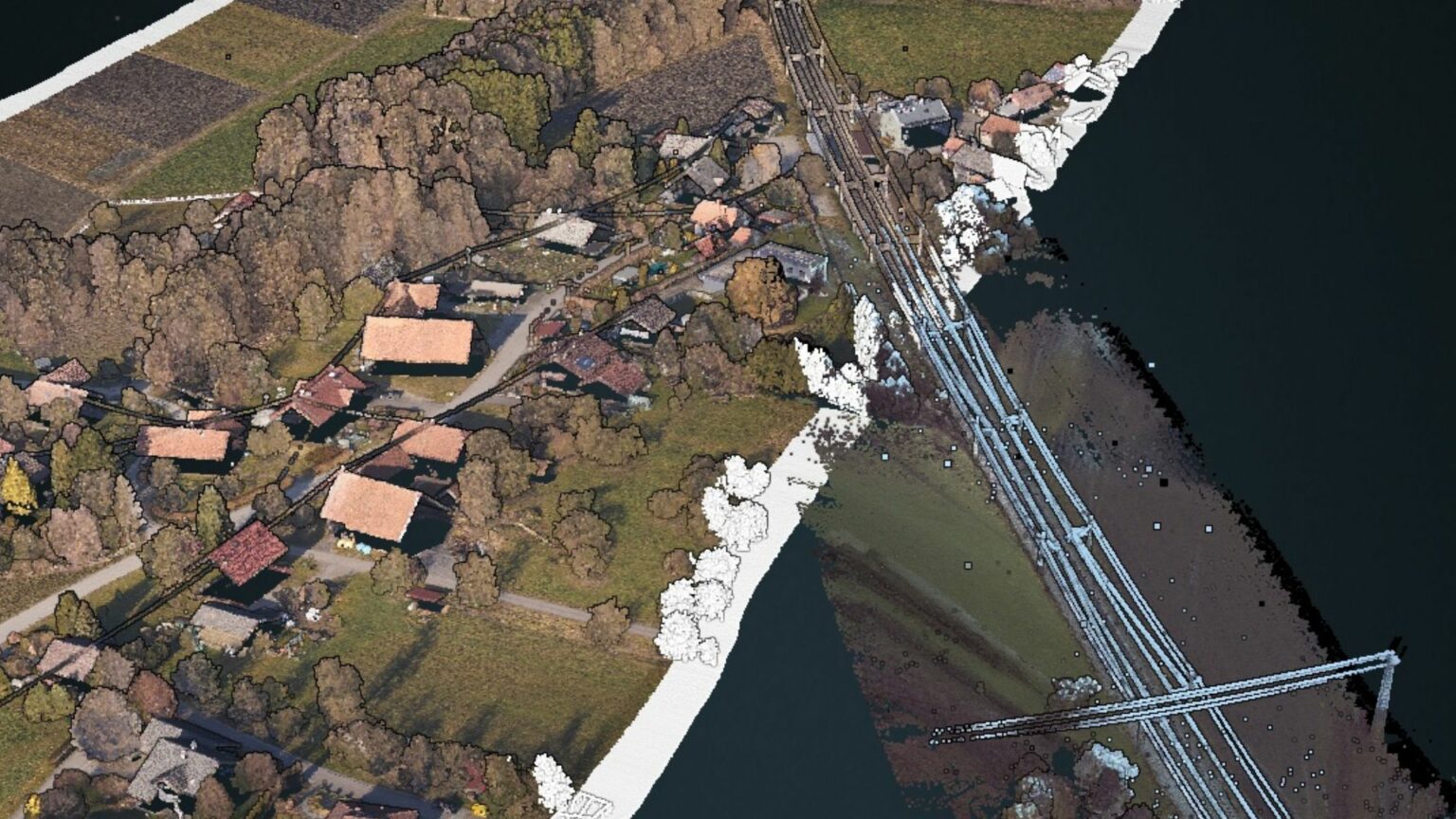
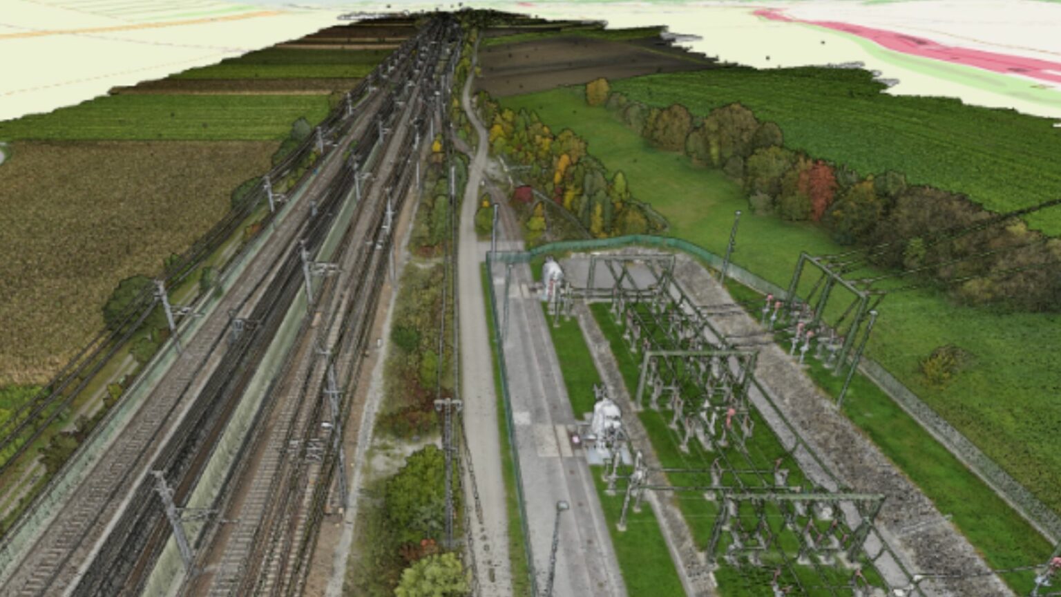
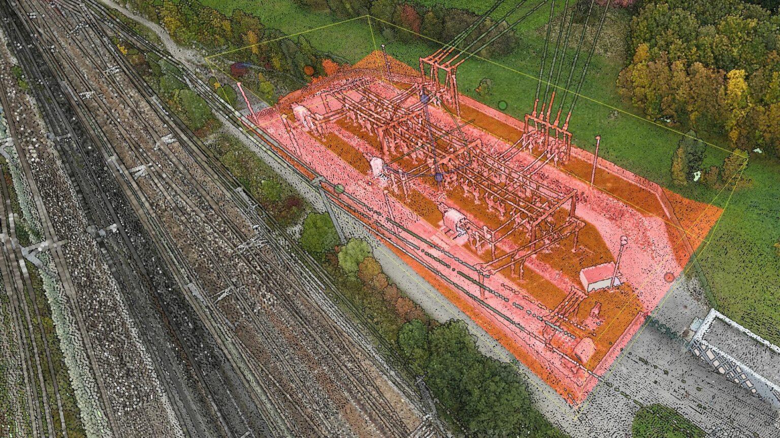
Object & Terrain Visualization
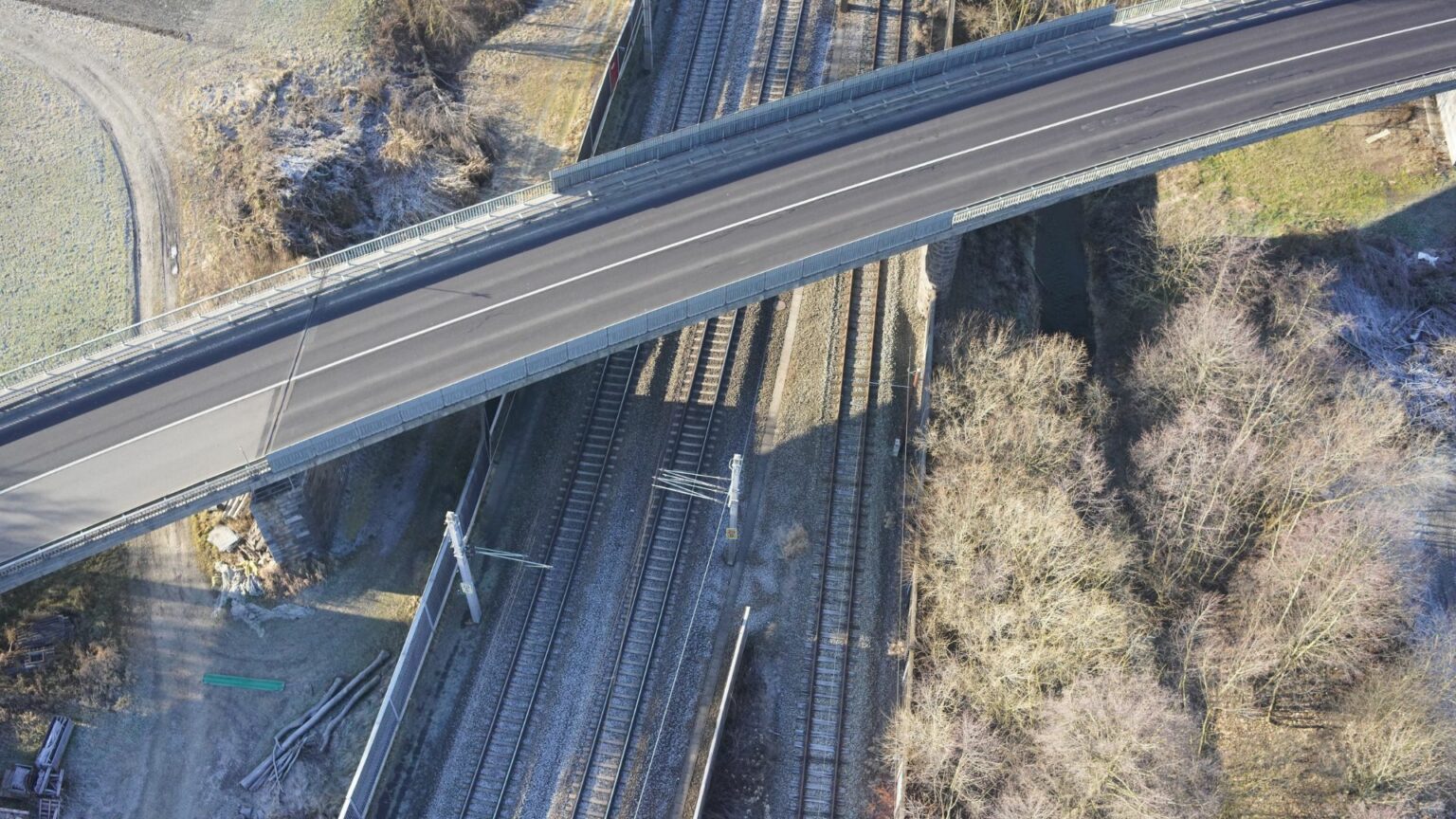
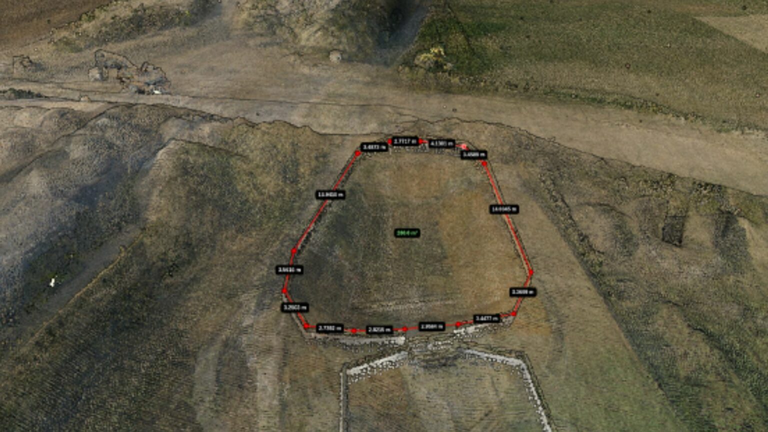
In the planning phase of new railway, energy, or roadway paths, SmartDigital conducts an in-depth terrain assessment, covering several hundred meters around the proposed route. In the process, the planned areas are precisely surveyed and the required distances are determined. Automated checks identify potential threats, like vegetation or trees at risk of falling in the projected development zone, marking out the hazardous regions.
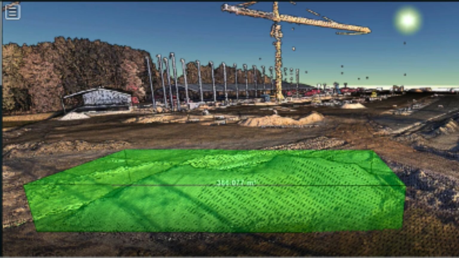
Another use case is the effective management of construction sites. Construction site management is a complex process that involves various aspects – from monitoring construction progress to coordinating tasks and ensuring work safety.
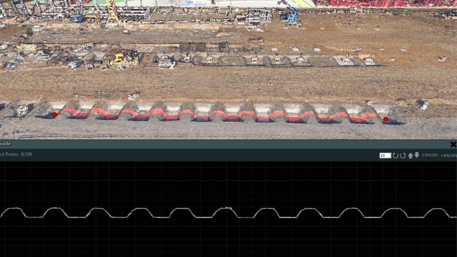
For existing construction sites, SmartDigital provides a detailed insight into the construction site, presenting the construction progression as a digital twin. Through these detailed recordings, volumes of construction debris and materials can be precisely measured, enabling accurate billing.
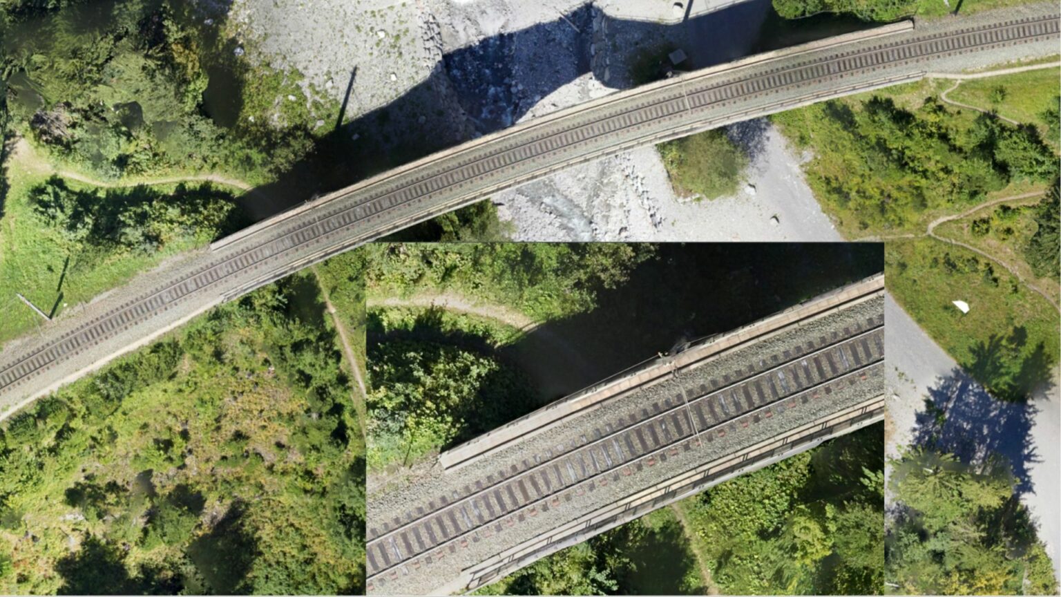
Object Recognition & Inventory
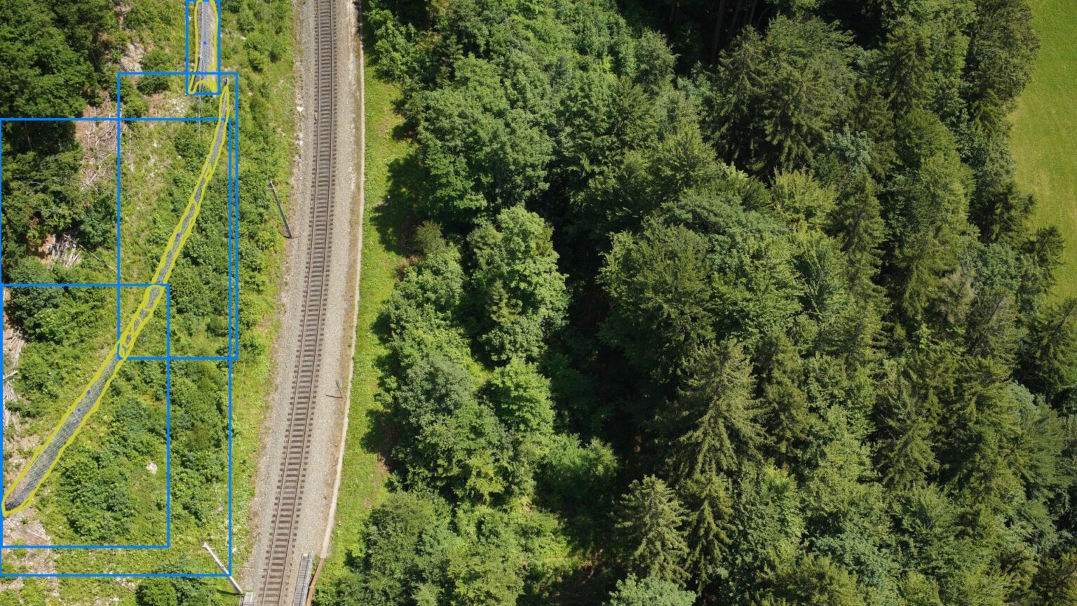
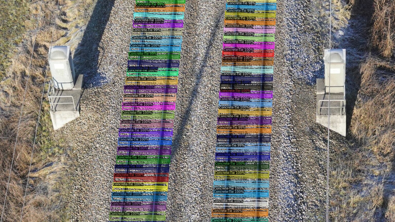
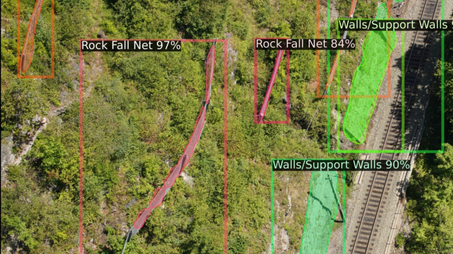
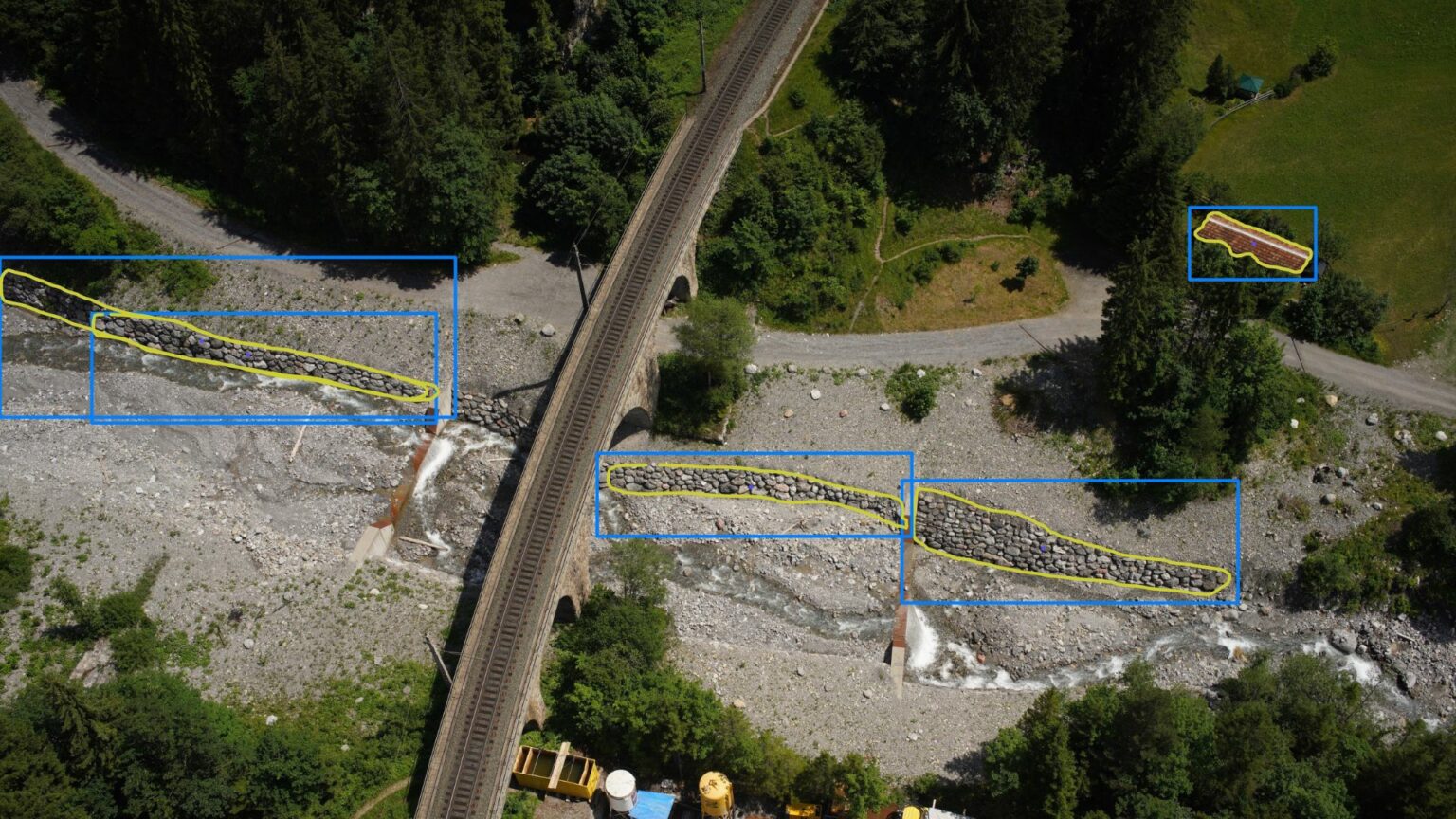
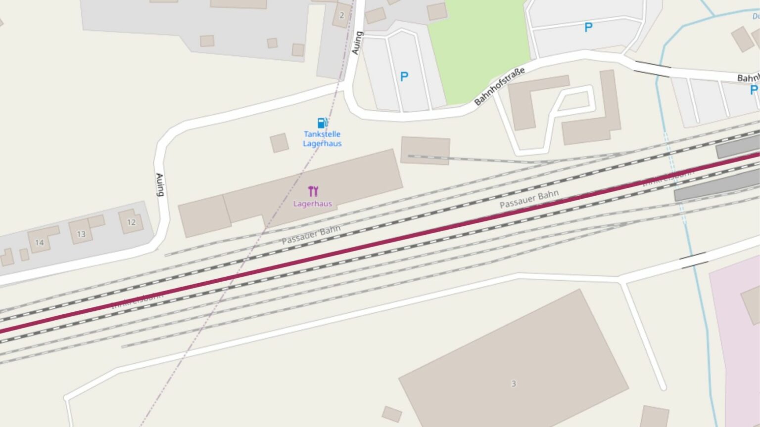
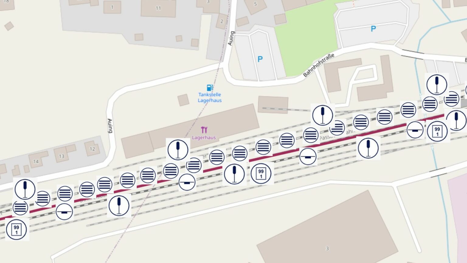
For a consistent digital cataloging of crucial infrastructure, it’s vital to recognize objects along a planned or existing pathway, including items like poles, insulators, ties, switches, guardrails, and traffic signs. Safety structures such as avalanche barriers, rockfall nets, retaining walls, and sound barriers need to be identified and mapped as well.
This capability enables automatic detection and listing of these components, inclusive of their geographical coordinates.
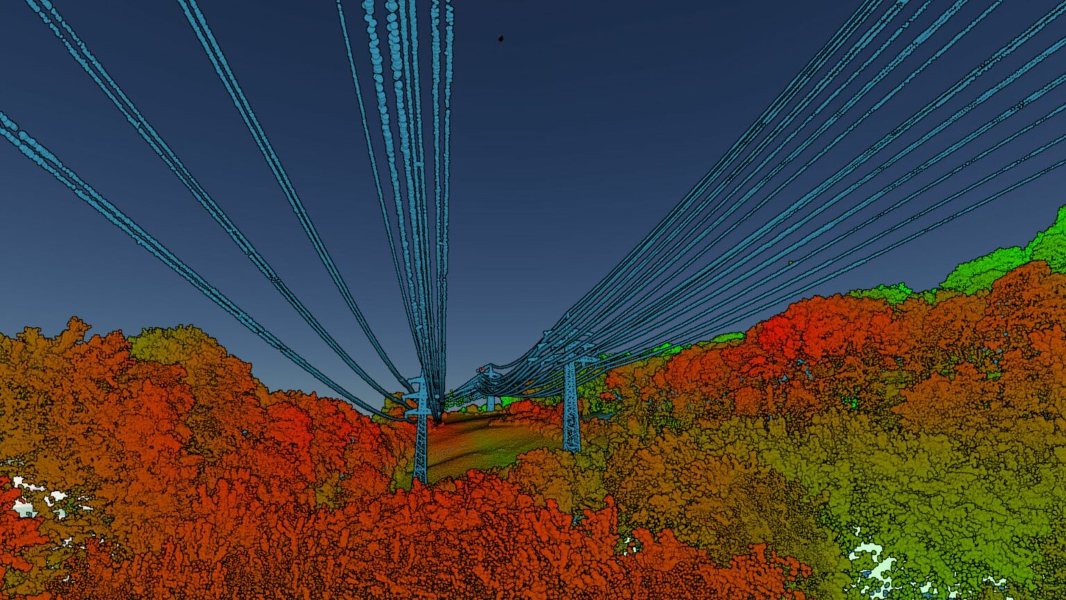
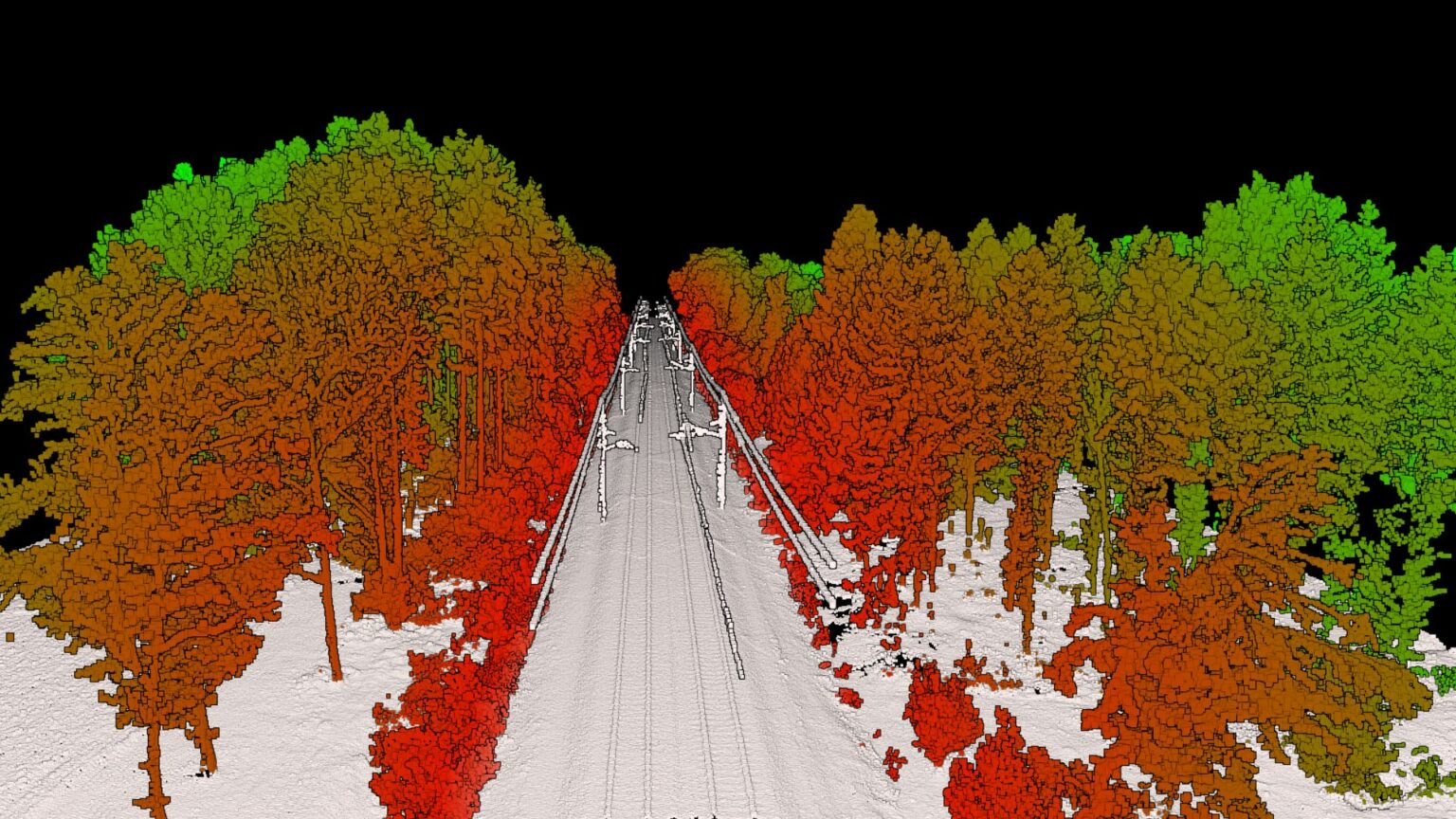
Leveraging aerial data gathering methods (like video, infrared, and laser) followed by AI-driven processing and analysis, the entire landscape is digitally archived and categorized. Furthermore, this tech grants the flexibility to visualize the data as needed, even for past records.
Condition Monitoring
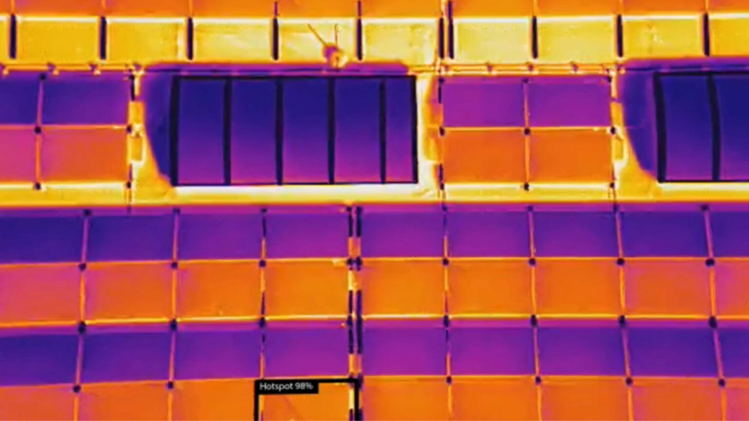
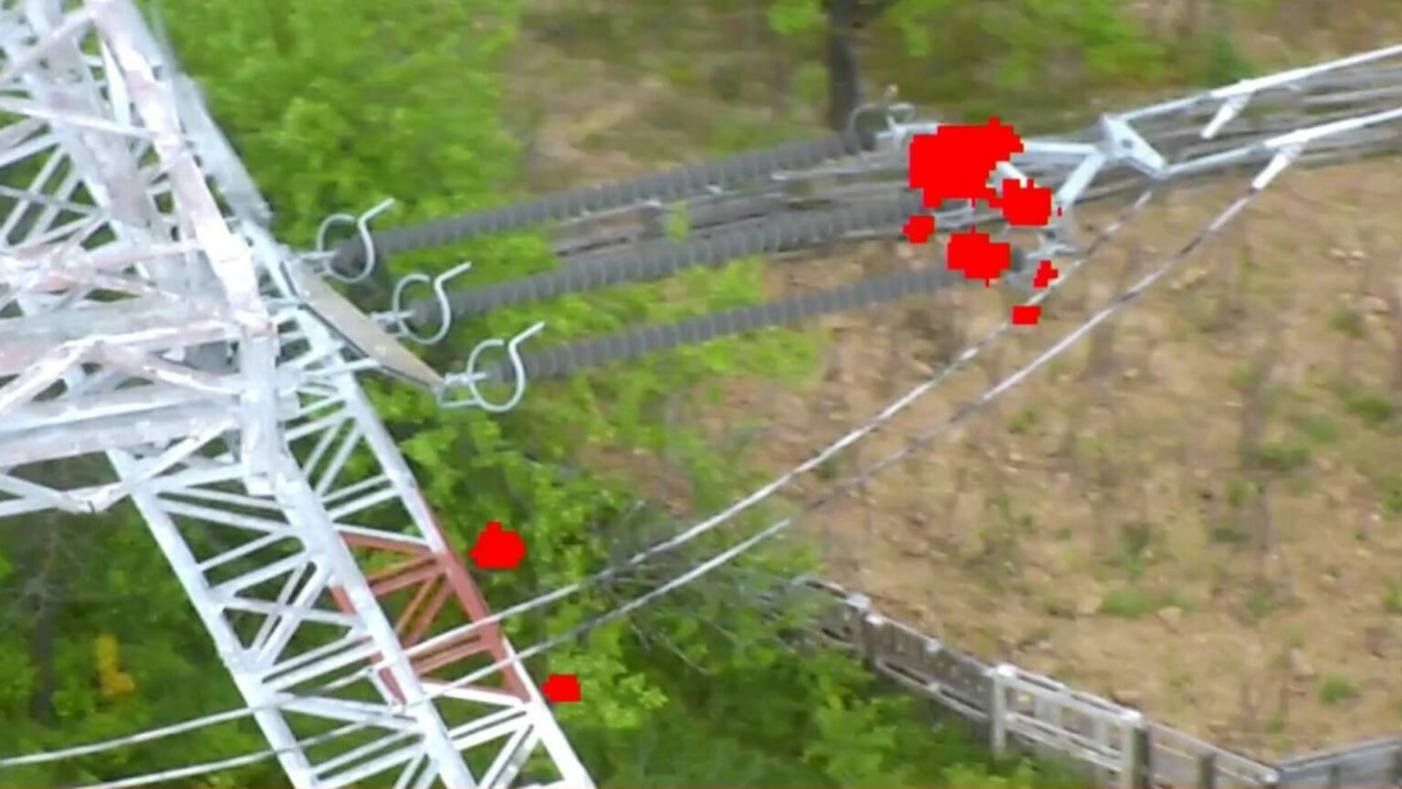
AI-powered image analysis automatically identifies objects and a comparison between current and past images is conducted. When inconsistencies arise, an IoT system activates an alert, promptly forwarding the image of the concern area, inclusive of exact geo-coordinates, to a designated team. This expedites the planning for required maintenance or fine-tuning of the service cycle.
Vegetation, particularly trees, when not timely addressed, may pose challenges. AI-backed image assessments consistently monitor the tree-fall perimeter, facilitating systematic, automated surveillance.
Unmanned aerial systems (UAS) stand out as a preferred choice for forward-thinking maintenance. Their periodic route surveys, coupled with data analytics, negate the need for on-foot or vehicular path inspections.
The uniform documentation of entities, complemented by AI-aided condition change evaluations, ensures swift problem identification. Consequently, potential threats like building fractures, tumbling rocks, looming landslides, and related dangers are flagged early on, ensuring timely and effective solutions.
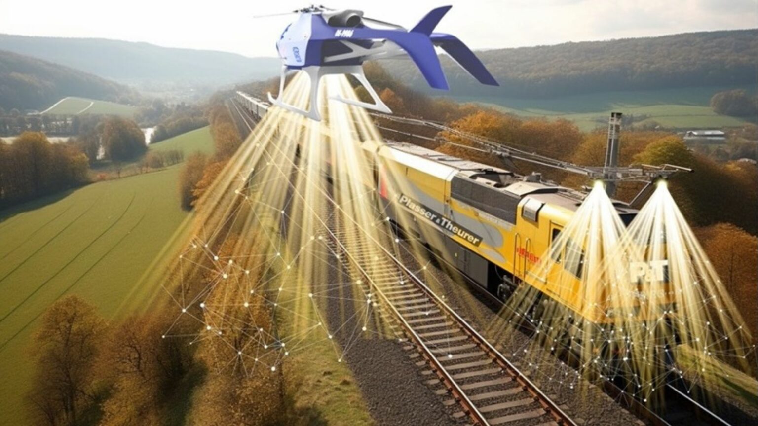
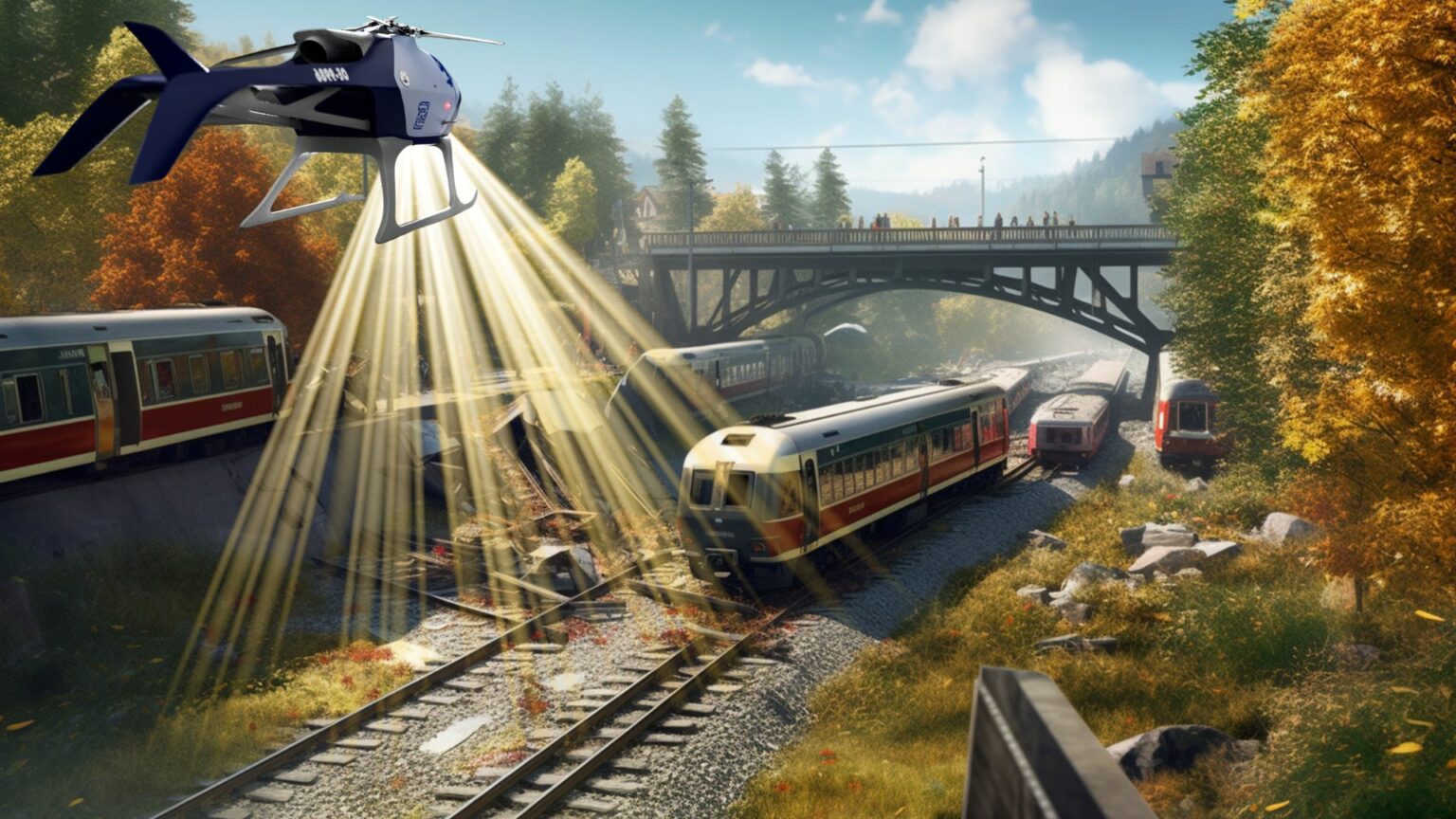
Incident Recognition and Emergency Exploration
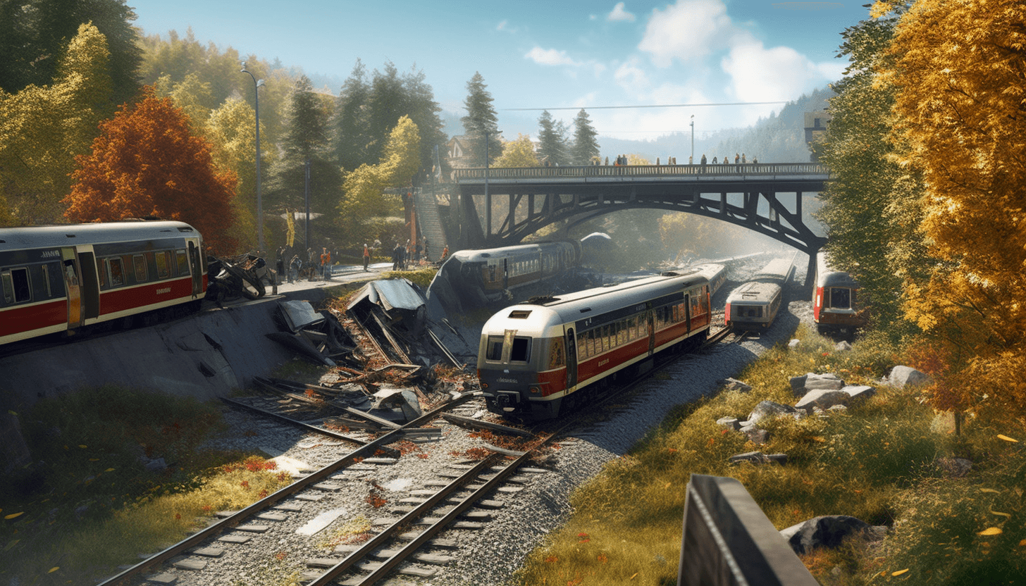
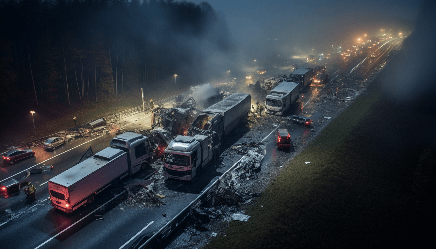
As operators of critical infrastructure such as rail, energy and road networks, it is crucial to be prepared for unforeseen events and emergencies that could disrupt 24/7 operations. This is where drone technology can make a significant contribution.
Through UAS, infrastructure managers can swiftly gain an immediate understanding of a situation, performing visual checks and gathering vital data for issue resolution. This real-time insight enhances the speed and efficacy of decision-making during emergencies.
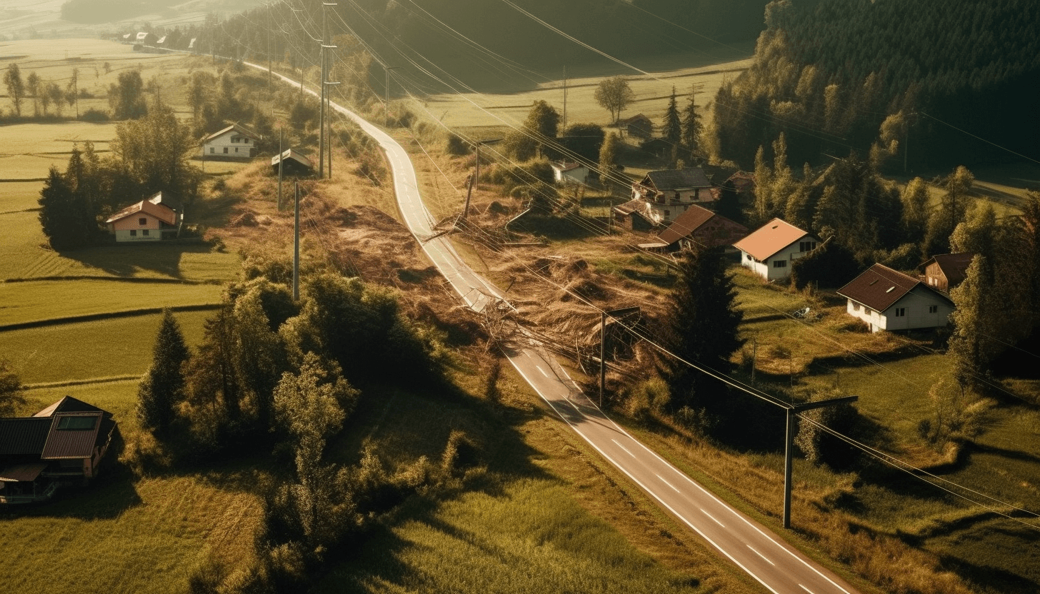
UAS can also be used to monitor and inspect the network after storms or other natural disasters. They offer rapid damage assessments, facilitating prompt interventions by zooming in on impacted areas and pinpointing essential repair needs.
SmartDigital’s seamless integration of “live views” on the UAS ensures real-time flight monitoring, empowering teams to respond instantly – even during nighttime operations
easy to use: multiple users including customized role management
time and location-independent availability of all data
easy handling of the entire process from order to report
Expert reports
2D, 3D, 3D VR, live video, etc.
appropriate decision-relevant systems for all asset management tasks
use of appropriate data augmentation to provide excellent asset visibility
fast and accurate decision-making based on dynamic data reports
customized alerting systems
One-stop-shop
handling of the entire process in one place
end-to-end process from the order to individualized reports
clear and transparent service fulfilment
Blockchain
Blockchain
Die Blockchain dient der beweissicheren, lückenlosen, und gerichtsfesten Dokumentation der erbrachten Leistungen. Die Daten werden verschlüsselt und nur berechtigten Personen zugänglich gemacht.
Bilder und Daten werden in der ARCA von einer Künstlichen Intelligenz zu einer neuen Realität angelernt. Die Daten werden den jeweiligen Kunden-Realitäten zugeordnet (z.B.: Straße, Bahn, Energie, Vegetation, Infrastruktur Bauwerke,…) und ARCA erstellt automatisch den gewünschten Report.
Werden Abweichungen zur angelernten Realität festgestellt, löst ARCA einen automatischen IoT-Trigger aus, oder gibt diese Abweichungen als Anomalie an, weil diese nicht mit der angelernten Realität - Mustererkennung übereinstimmt.
Skalierbarkeit
Skalierbarkeit
Überprüft wurde ARCA von hochskalierenden Testsystemen, die 30.000 Drohnenflüge simultan in der Cloud simuliert haben und jede dieser Drohnen 4 mal in der Sekunde ihre fiktiven Telemetrie Daten (Position, Flughöhe, Geschwindigkeit, …) an die Plattform geschickt haben. ARCA verarbeitet bis zu 117.000 Datensätze pro Sekunde, oder bis zu 420 Mio. Datensätze in der Stunde.
Die Rechnungserstellung erfolgt direkt und zeitgesteuert aus der ARCA Blockchain.
Multimandanten-
fähigkeit
Multimandanten-
fähigkeit
Alle Kunden werden gleichzeitig und sicher von nur einem IT-System verwaltet.
Einsatzgebiete
Bilder und Daten aus verschiedensten Sensoren zu Land, zu Wasser, in der Luft, aus stationären, oder ERP-Systemen: Die hochskalierende Service Delivery Plattform ARCA selektiert, analysiert und dokumentiert diese Daten in einer fälschungssicheren Blockchain mithilfe von Künstlicher Intelligenz in einem durchgängigen automatisierten End-to-End Prozess.
Je nach Anwendungsszenario greift SmartDigital dabei zusätzlich auf UAS -Unmanned Aircraft Systems- Dienstleistungen seines 100-prozentigen Tochterunternehmens EuroDragons zurück.
Infrastruktureinrichtungen
Bahnlinien, Straßen- und Wegeinfrastruktur, Bauwerke, Brücken, Tunnel, Bergbaueinrichtungen